Steens Mountain Getaway

Memorable scenes from Oregon’s forgotten corner

Growing up in Bend, people mentioned Steens Mountain every now and again, but I struggled to imagine what it might actually be like. My impression of Southeastern Oregon was of a vast, monotonous landscape covered in volcanic rock and juniper trees, and that was about it. The idea of there being an actual snow-covered mountain out there sort of baffled me. That’s why I was so excited to see it for myself when my sister and I did a three-day camping trip in the Steens Mountain Wilderness. 

On an early summer morning, we packed up our car and headed east out of Bend on Highway 20 toward the small town of Burns. It just so happened that I had already done this drive a couple weeks prior to rescue my friend after a car crash. Although I was happy to help her out, I wasn’t too excited about doing the drive again so soon — it’s not the most scenic highway in the world. 

After about two hours, we reached Burns and made sure to fill up on gas before we headed south into one of the most remote areas of Oregon. Besides the occasional homestead, there really isn’t any civilization along Highway 205 between Burns and Steens Mountain. As we traveled further south, I kept looking out the window, wondering which piece of topography on the horizon we were destined for. I could just make out an amorphous snow-capped mountain in the distance. Could that be it? 

I wouldn’t know for sure until we approached Steens Mountain Loop about an hour later. The well-maintained gravel road traveled east towards the mountain, gradually gaining elevation through the desert. The features of the fault block that is Steens became more and more refined as we followed the road higher and higher. We could see stripes of snow contouring the layers of the headwall of a large canyon, which cut through a slab of land elevated above the surrounding desertous country. It was a type of landform I’d never really seen before, having been accustomed to the obvious prominence of the Cascade volcanoes, or the expansive peaks of the Sierra Nevada. The closer we got, the more our anticipation grew.

At about two o’clock in the afternoon, we arrived at the trailhead in South Steens Campground. We ate our lunch in the shade of a juniper tree, then prepped our backpacks for our hike into the Big Indian Gorge, one of the mountain’s magnificent glacier-carved valleys. Once we had lathered up in sunscreen and laced up our boots, we were ready to head up toward the mountain. 

The first mile of the hike was pretty dry and exposed, the only vegetation being bunch grass and sagebrush. It was the kind of landscape where you felt like you were bound to come across a rattlesnake — in fact there was a sign cautioning about their presence near the trailhead, which my sister was not excited to see. As I scanned our surroundings for any serpentine figures, I noticed the area was dotted with pretty decent-sized rocks, some of them as big as our backpacks. I wondered if they were deposited there by the glacier that once filled the valley we were about to make our way up.

We climbed steadily uphill through grassland until we reached the canyon opening, at which point the trail cut into the side of a canyon wall and became more varied in terrain. Eventually, we approached the first of three stream crossings, which we had read about while researching the Big Indian Gorge trail. Coming into the hike, we were anxious to see whether the water would be too high and swift for us to cross, so we were relieved to find out it was actually pretty shallow. We stopped to switch over into our Chacos and set out across the creek, which was only about 20 feet wide. 

As we continued up a narrow, windy section of the canyon for another mile or so, we successfully maneuvered through each creek crossing we faced. My sister and I let out whoops and hollers every time we entered the bone-chilling water, just like we used to do when we took ice baths after soccer practice in high school. On a hot day like this, the creek crossings turned out to be an aspect of the hike we really appreciated.

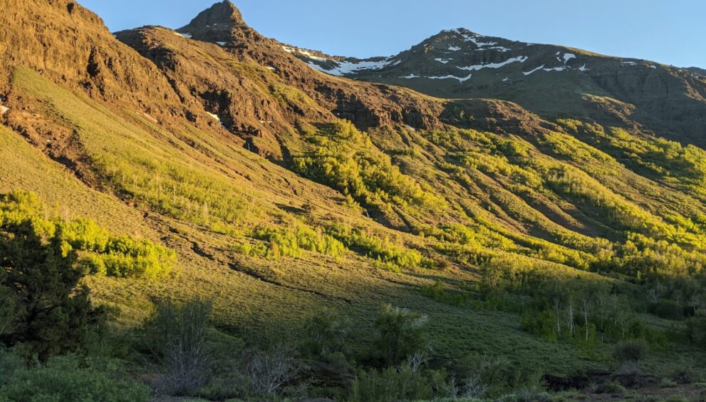
About half-way into the hike, the canyon opened up and we could see all the way up the gorge to the snowy headwall. The true U-shape of the valley was suddenly so profound. Orange, purple, and yellow wildflowers sprinkled the landscape, which became more lush and green the further up we climbed. There were still plenty of junipers around, but there were also cottonwoods and quaking aspens, whose leaves rustled gently in the breeze and provided us with much-needed shade. 

We hiked through a series of magnificent aspen groves, home to some of the fattest aspen trees I had ever seen. Each time the view opened up again, we could see waterfalls cascading down the steep cliffs of the canyon on either side of us. A few miles later, the trail approached a waterfall of its own on top of a bluff overlooking the valley below. Hungry and exhausted, we figured this would be a great place to set up camp for the evening.

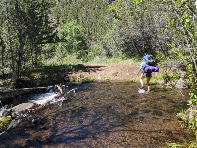
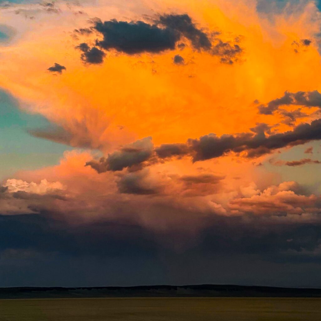
After cooling off in the nearby stream, we fired up the ol’ Esbit stove and got some water going for spicy peanut butter ramen. Sadly, the peanut butter-sriracha-soy sauce concoction I had so lovingly prepared for us before we left home was forgotten in the cooler sitting in our car, so we had to settle for the inauthentic seasoning that came inside our Top Ramen packets. Of course, when you’re out backpacking, virtually all food tastes good, so we weren’t too bummed out (I was a little bummed though). We watched the sun slowly dip below the canyon walls while we slurped our ramen in front of a beautiful backdrop of the headwall turning a deeper orange by the minute.

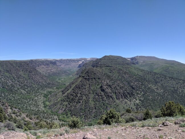
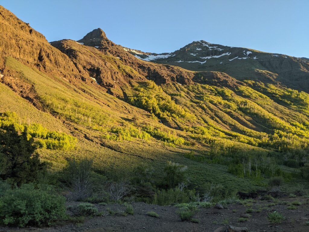
All around us, there were geological features I could identify from my class on mountains and glaciers in college, which I couldn’t help but point out to my sister while we ate. High up above, there was an arete — a sharp crest of rock carved out from two adjacent glaciers — and a cirque — a bowl-shaped depression left behind from a single glacier. And below us, of course, was the massive U-shaped valley of the Big Indian Gorge, which was formed from the enormous glacier that once dominated the entire landscape we saw before us. The smaller glaciers that created the arete and cirque above us would’ve fed into the main glacier down below. I wondered what this place would’ve been like when it was all covered in snow and ice. As the shadow of the canyon walls creeped up the headwall behind us, I took in the view to my heart’s content, appreciating the amazing geological processes that formed such a beautiful place.

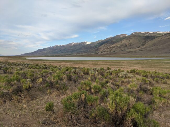
The next morning, we had an easy four-mile hike out and got back to the trailhead by noon. After grabbing some lunch out of the cooler, where my spicy peanut butter concoction was indeed floating in ice water, we decided to drive further up Steens Mountain Loop and see what we could see. We followed the winding road up until we reached a viewpoint overlooking two glacier-carved valleys, including the Big Indian Gorge we had just hiked out of. To the southwest, we could see the dry, desertous landscape of Eastern Oregon stretching out to the horizon below. We had hoped to be able to continue up to the summit of Steens Mountain, but to our dismay, there was a gate blocking our way with a sign saying “road closed.” I can’t remember exactly why, but I guess it gives me a reason to visit again. 

We decided to drive back down and loop around to the other side of the mountain, where we planned on camping for the evening. Once we returned to the main highway, we drove south to a junction located in the small ranching community of Fields. It was already well over 90 degrees when we pulled into the parking lot at Fields Station in the hopes of getting a milkshake — I was particularly interested in the “dreamcicle” flavor — but they were closed due to COVID-19. Yet another dream(cicle) crushed by the pandemic. 

.

After having a snack and relieving our bladders, we got back onto the road and turned onto a new highway heading north along the east side of Steens Mountain — a completely different view from the west side. While the west side of the mountain involves a gradual ascent up to the summit, the east side features a steep and relatively abrupt drop-off to the desert below. In fact, there is about a mile of relief between the summit of Steens Mountain and the Alvord Desert, an expansive playa lake that lies in the mountain’s rain shadow. Driving along this side of Steens, I was reminded of the views I witnessed from Highway 395 that runs along the east side of the Sierra Nevada. Although there is a huge elevation difference between Steens and, say, Mt. Whitney, it was the stark contrast between where I was sitting and where I was looking that gave me the same sense of awe I experienced while gawking up at the Sierras on a trip several years ago. 

Eventually we drove over a ridge and the Alvord Desert suddenly came into view below us. I was immediately impressed by its vast monotony, a bright white surface sticking out like a sore thumb against textured, vegetated surroundings. We thought about finding a way to drive down to it, but with temperatures in the triple digits, standing in the middle of a hot, dry desert didn’t seem too enticing. Yet another reason to come back out for a visit one day. 

 We continued our drive along the east side of Steens Mountain — which, from this angle, looked more like a mountain range rather than a single mountain — until we got to our campground for the evening at Mann Lake. The lake lies at the northern end of Steens, and while its beaches were mucky and a bit difficult to walk on, the view of the snow-capped

peaks over the water was pretty outstanding. While the late afternoon sun was persistently cooking us to a crisp, we hid in the shade of our trusty steed while cooking up a meal of our own — bulgur pilaf with tomato sauce, sun-dried tomatoes, and shallots — all in my tiny Esbit stove. We ate to our heart’s content, then retreated to our tent to play cribbage once the mosquitoes came out, watching the sun dip below the mountain once more.

 Driving home the next day, I had a newfound appreciation for the bottom right corner of my home state. While the trip failed to change my impression of Southeastern Oregon being primarily a vast, monotonous landscape covered in volcanic rock and juniper trees, it did prove me wrong on that being “about it.” Steens Mountain opened my eyes to an entirely new, diverse, and beautiful landscape that I never expected to encounter on those open roads. To me, Steens is one of the most unique examples of the rich volcanic history of Oregon, and I’m itching to get back out there again soon — or are those just the mosquito bites?

Steens Mountain Getaway

Help Wanted

You Oughta Know: Eric Leadbetter

Leave a comment

Your email address will not be published. Required fields are marked *